
Starts in 4h
🌲 OutdoorFree
Mt. McCoy to the Cross and back WEEKLY HIKE (Simi Valley)
DESCRIPTION OF HIKE: Moderate 3 miles RT with 675’ of elevation gain/loss
Today · 4:00 PM
1464 Madera Rd
Simi Valley, CA
This Tuesday · 4:00 PM · Old Bridgegate Trailhead · Westlake Village, CA
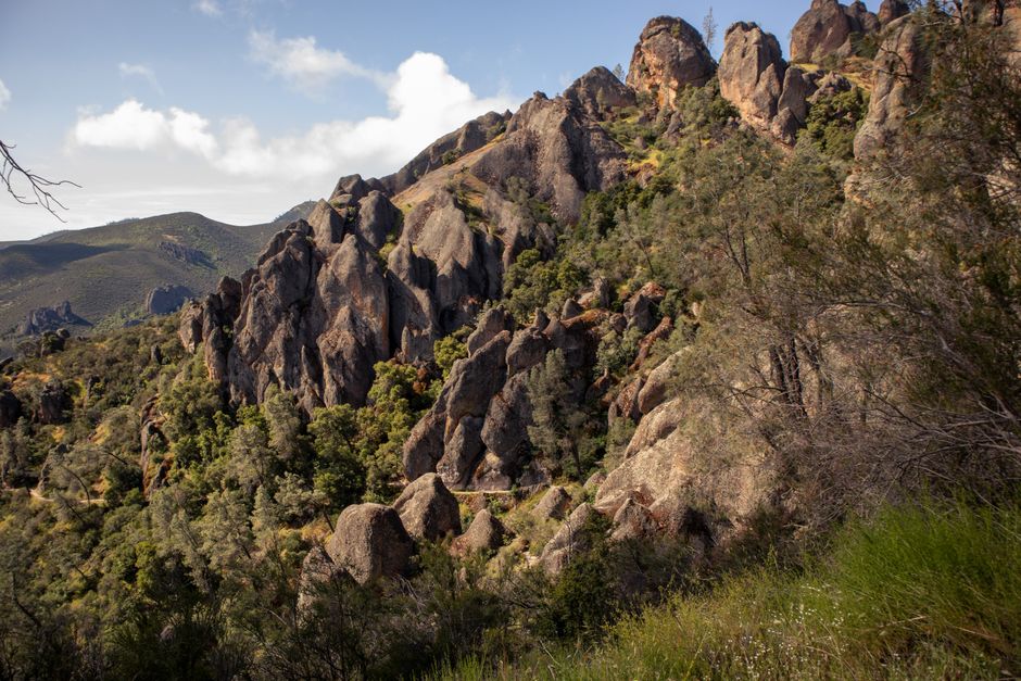
Note: we will cut this to about 4 miles and avoid the “descent to death” part of the trail 😅🤣 Highlights CONEJO OPEN SPACE FOUNDATION • Brookview Trail runs mostly along a ridgeline so you get great views to the south over Lake Sherwood and north over Thousand Oaks. • Brookview and White Horse Canyon Trails are quite remote and rugged, so they are great for getting away from the crowds. • Brookview Trail is a segment of the 2026 Conejo Open Space Challenge (https://cosf.org/challenge; colored pink on the map below). Description The Brookview Trail is quite remote and rugged and is the first leg of this moderate 4.5-mile lollipop loop. You'll likely have the amazing views in all directions to yourself and your companions. When the trail turns south and downhill, you'll want to make sure to take the side trail on the right (when traveling clockwise around the loop) to avoid the steep, rocky and loose section known affectionately by some mountain bikers as "The Descent of Death." This bypass trail was built in the 2014 COSCA Annual Fall Trail Work Day by dozens of volunteers. Key Statistics Distance: 4.5 miles. Cumulative Climbing and Descent: About 950'. Parking: Free at the side of the road at the top (north-west end) of Brookview Avenue. Popularity: Most of this route is quite remote so you probably won't see other people on much of it. Los Robles Trail East (Edison Road) is much more popular. Tread Surface: Hard packed trails of various widths. Some sections have minor ruts and/or possibly slippery loose sand on top. Long stretches are quite rough. Hazards: There are some long stretches of very uneven surfaces. The north end of White Horse Canyon Trail, where it meets Los Robles Trail east, is steep and very rocky for about 500'. Facilities: There is a picnic table up a very short hill where Brookview and Los Robles South Trails meet. Connections: To many other trails in the Los Robles East area. Directions: From the 101 Freeway in Thousand Oaks, turn south on Westlake Blvd. Drive for 1.2 miles and turn right on Bridgegate St. Drive for 0.3 miles before turning right onto Brookview Ave. The trailhead is 0.6 miles ahead at the end of the road. Map: https://bit.ly/4aeF1nQ
DESCRIPTION OF HIKE: Moderate 3 miles RT with 675’ of elevation gain/loss
Today · 4:00 PM
1464 Madera Rd
Simi Valley, CAApril 14, 2026
4:00 PM – 4:00 PM
Free
Conejo Valley Hikers, Walkers & More! (Beginner+)
Organizer
All Ages
Age Group
The Harmon Canyon Nature preserve is absolutely stunning, and right in the back yard of Ventura!
Today · 5:45 PM
Harmon Canyon Preserve
Ventura, CA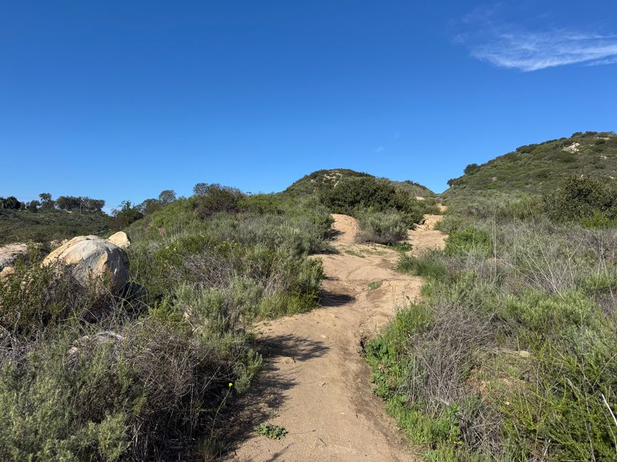
Learn about native plants and local wildlife
Tomorrow · 4:00 PM
Harmon Canyon Preserve
Ventura, CA
UC Master Gardeners of Ventura County
This Tuesday · 12:30 AM
Ventura County Library
Ventura, CA